A while back, after a wonderful day driving The Apache Trail, I told Vic that I thought it might be fun to drive and view in the opposite direction. Being the great guy that he is, he planned this day where we reversed direction on that trail followed by driving the Four Peaks Trail. It was another really special day!
On our previous trip the light was wrong making it impossible to photograph Canyon Lake at the Apache Junction end of the trail . If only there weren't power lines going across the sky. I guess I'm going to have to learn how to use PhotoShop.
This end of the trail is covered with lime green lichen.
This 1.7 mile segment of the trail switchbacks constantly and is not wide enough for two vehicles to pass except where there is the occasional pullout right on the edge.
The final turn at the base crosses the scenic Fish Creek Bridge.
Another bridge beneath a huge monolith
We have nearly reached Roosevelt Dam and Bridge at the other end of the trail.
Roosevelt Lake is awesome in its beauty.
The earliest brittlebush is blooming.
God and Mother Nature are working hand in hand.
The Four Peaks Trail begins.
Our first glimpse of the Four Peaks
This is too cute - a .1 mile shelf road is built around this tiny knoll.
What fun it was to drive around and......
....to have this great view of a portion of the road we came up.
Much nearer to the Four Peaks
It's our understanding that there is amethyst to be found between two of the peaks.
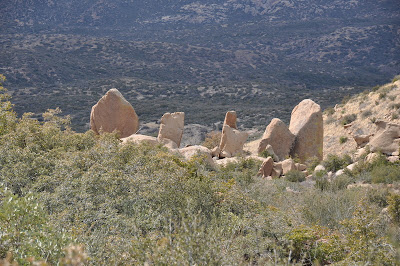
Funny, the many different geologic formations to be found.
Woohoo!
I wonder what's on the other side of this hill.....
.....jumbles of rocks and a lone saguaro growing out of this particular heap.
Weaver's Needle is the distinctive formation on the horizon. It is named for Pauline Weaver, an American mountain man who lived in the 1800s. He was a military scout, trapper, prospector and explorer. A number of geographic locations in Arizona have been named for him. This formation is in the Superstition Mountains and is 1000 ft high.
Thanks, Vic! You're the best!


